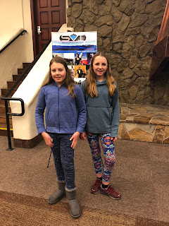
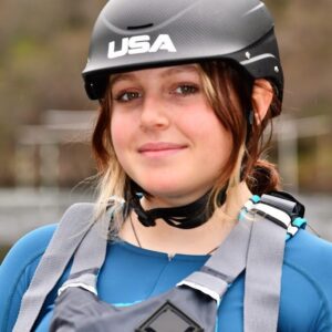
Last night, Laurel and I gave a presentation about the Truckee River Source to Sea expedition as the opening to a documentary movie premier. The movie, A River’s Last Chance, talks about the challenges that have faced the Eel River watershed over the past 100 years. Some similar issues face all of our rivers in California. Below is our power point presentation and our presentation script. I had fun preparing for this with Laurel and appreciated that several of my teachers, friends, and fellow student ambassadors came out to support us.
 |
| Me and Laurel before our presentation |
 |
| Sold out crowd! |
 |
| Me and Laurel finishing up our presentation |
Truckee StS Powerpoint Presentation
Did you know that the Truckee river watershed is 145 miles long, or that Lake Tahoe is the 2nd deepest lake in North America? Last summer, Laurel and I joined the Rivers For Change Truckee River Source to Sea expedition. We learned how the Truckee River evolves from its start to its finish and its importance to the communities along the way.
The paddling team consisted of 10 Student Ambassadors from 7 schools in the Truckee River watershed, led by Team Leader Sue Norman, and Jay Wild of Lake Tahoe Waterman’s Association.
The trip started at in the upper watershed above South Lake Tahoe, and the student team explored six different sections of the river and watershed to its terminus in Pyramid Lake.
We started at the Upper Truckee River in Meyers, CA above Lake Tahoe. There, we experienced the river bank restoration work that the Forest Service had completed. As you can see in the photos, the river banks are now marshes and meadowland which provides habitat for wildlife and has brought many new plants. We learned that the long toed Salamander returned to this area thanks to the restoration project.
Next, we traveled across Lake Tahoe in an outrigger canoe. We paddled 12 miles from Camp Richardson to Meeks Bay, including paddling around Fannet Island in Emerald Bay. At one point our team was paddling the canoe at a speed of 7 miles an hour, faster than the motor on the support sailboat. We learned about the efforts of multiple agencies to restore lake clarity, through preventing erosion of sediments. Because of urbanization, lake clarity has decreased from 90 feet to 60 feet in depth. But restoration efforts appear to be slowing the rate of continued loss of lake clarity.
Rivers for Change then hosted a field trip at the regional park in Truckee for local students. We led a hands on lesson on water supply and demand. We used buckets to simulate water allocation for fish, recreation, agriculture, and industrial use based on actual Truckee River scenarios. Students quickly realized that in drought years there is not enough water to meet all the demand. Future predicted climate change is likely to make this situation worse for our generation. The worst drought ever recorded over the past 100 years occured in our life time, from 2012 through 2015. There was also a river safety and rescue demonstration by the Truckee Fire District Swiftwater Rescue Team.
We then rafted with I.R.I.E, a local rafting company, from Gooseneck meadows to Glennshire. We were joined by parents, guest paddlers, and members of the Truckee River Watershed Council. It was so fun to paddle Class III whitewater through the town of Truckee. The last time the river was that high in June was 34 year ago, in 1983. We may not see flows that high in the summer again until we are grown with children of our own. We learned about geomorphology. Geomorphology is the science of how rivers are impacted by topography, geology, and hydrology. We noted how drastically the landscape and river had changed during our journey so far.
Next, Tahoe Whitewater Tours, another local rafting company, guided us from Verdi to the Reno Whitewater Park. This was the coldest day of our journey, and we had to paddle over a couple of dams (including one that was 10 feet high), and portaged another. These dams are dangerous for people who are not experienced and also do not allow fish migration. Many organizations are working to try to get these dams removed or rebuilt to address these problems.
We then camped east of Reno at McCarran Preserve, managed by the Nature Conservancy of Nevada. At the preserve the restoration work by the Conservancy was noticeable, with willows lining the banks and like the Upper Truckee, much of the land around us was marshes. The next morning we kayaked from Lockwood to USA parkway. At the top of this section, the hills were eroded and there were train tracks and power plants on the side of the river. As we got closer to the Preserve, we began to see more results of completed Conservancy restoration, as we paddled next to thick restored Cottonwood forests. We met and paddled with multiple stewardship partners on this day including, The Nature Conservancy, One Truckee River, the Nevada Division of Wildlife, and the Truckee Meadows Water Authority. We learned about the resource values these groups are concerned about — fish and wildlife habitat, drinking water supply, and recreation along the river — and their efforts to protect and restore those values in the Truckee River.
We were unable to finish the rest of our journey by water, as the river runs through Paiute Indian tribal land, and they felt the river was to dangerous to paddle. So, we biked to Pyramid Lake instead on the last section of the Tahoe Pyramid Bikeway.
We stopped at Marble Bluff Dam and Fish Passage facility, where we saw a very unique fish ladder. In order to migrate upstream to where the fish in Pyramid lake need to go to lay their eggs, they need to be transported up 40 feet in a fish elevator. The Truckee river eroded down this far at this location below the dam. This is the most dramatic example we saw of a change in geomorphology of the river because of a large change in river hydrology. The Derby Dam located 40 miles upstream of this location diverted all the water out of the Truckee River for many years. As a result, Pyramid Lake dropped 40 feet in surface water elevation, causing the river channel to erode down to the new surface height of the lake. The Marble Bluff Dam and fish passage facility was built to stop the erosion from continuing upstream, and to transport the fish up river during spawning season. We got to help the Fish and Wildlife Service catch and measure a sampling of Cui-ui sucker fish. Cui-ui fish are an endangered prehistoric fish species, only found in Pyramid Lake. Their number and size has steadily increased over the past 40 years since the Marble Bluff Fish Passage Facility was built. The Pyramid Lake Paiute Tribe depends on this fishery, as the majority of the tribes income is generated from selling fishing permits. Between March and June in 2017 over 500,000 fish were transported in the fish elevator up river to their spawning grounds.
We hope you have enjoyed this presentation of our experience and learnings during the first year of the Truckee River Source to Sea Paddling and Environmental Learning Project. Thank you!


